


(Path of the Mediterranean coastline of the E12)
Description:
Path not severe that leads from the port of Cape Palinuro on top where are located the Lighthouse and the weather station. It 'a path that makes enjoying the beautiful and majestic seascapes. Several coastal towers were built in the Aragonese period for coastal defense by the action of the Saracen pirates (1500-1600 such as) and still dot the overhanging rocks in the blue sea. Latest fortifications of Punta del Fortino and Golden Mount (Napoleonic era). Finally it comes down to the port of Palinuro through an easy path nestled in the pines. Vegetation typical of the Mediterranean coast and special endemism (Primula Palinuri).
Points of interest and environmental value:
Punta del Fortino - Centre and Tower of the quail - Faro – Torre Cala Fetente - Monte Fortino gold - Pineta.
Technical information of the path:
- The type of route: ring
- Segnavia: WHITE RED (BE)
- Point of origin and destination: Parking port of Palinuro
- Distance: about 5 km
- Drop: + 0 – 130 mt
- Lifespan: about hours 2,5 hours + stops
- Availability of water: at the start
- Difficulty level: T - Tourist – easy
- Note the level of difficulty: Path is not challenging but largely uncovered.
In summer avoid the midday heat and sun protection
Other useful information:
- Need to wear comfortable clothing suitable to the period and sports shoes with rubber soles not smooth (preferably hiking)
- At the end of the excursion, in summer, you can make the boat ride and visit to the caves of Cape Palinuro to make full visit
Download the data (pdf):

- Card Path
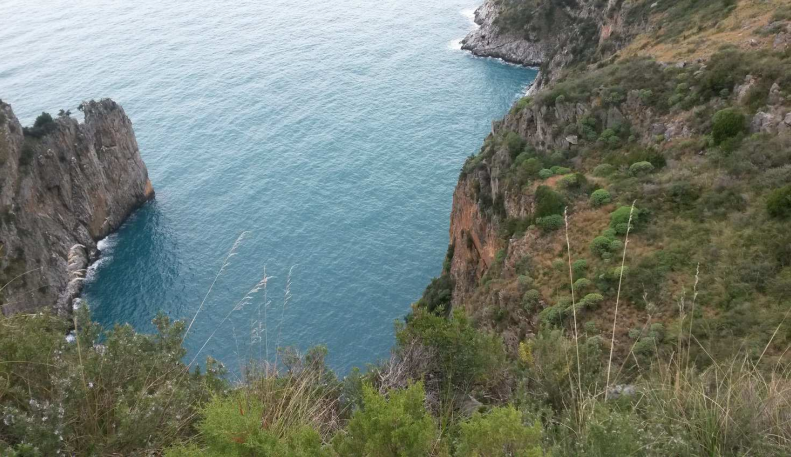
Landscape photo

[…] Altro e scheda escursione su: https://www.gettrek.it/2015/01/13/torri-capo-palinuro/ […]